Wednesday, May 23, 2018

Eastman Lake - Madera County, California


Visited on 5/21/2018, on my way back home to Sacramento from a business trip to give Drinking Water examinations in the Central Valley of California, I took the back roads over to Eastman Lake.  This is a 1,780 acre artificial lake formed by the construction of Buchanan Dam across the Chowchilla River in the foothills of Madera County, California. A small percentage of the northwest area of the reservoir is in Mariposa County.

This lake is at 453 feet above sea level and the Buchanan Dam was a 1975 flood control and irrigation project of the United States Army Corps of Engineers. The earthen dam is  218 feet high with a length of 1,746 feet at the crest.

Hensley Lake - Madera County, California


Visited on 5/21/2018, on my way back home to Sacramento from a business trip to give Drinking Water examinations in the Central Valley of California, I took the back roads over to Hensley Lake.  Hensley Lake is surrounded by the oak woodlands of the Sierra Nevada foothills. At an elevation of 541 feet above sea level, this 1,500-acre lake was created by the construction of Hidden Dam on the Fresno River. Built by the U.S. Army Corps of Engineers for flood control, irrigation, resource management, and recreation, the lake attracts a growing number of park visitors each year.

Located less than an hour drive northeast of Fresno in the foothills of the Sierra Nevada enroute to Yosemite National Park, the lake offers water skiing, fishing, swimming, horseback riding, mountain biking, hiking and camping.
The former Fresno River basin which is now Hensley Lake used to be home to the Miwok and Yokuts people. Their presence in the area is still evident, mostly in the form of milling areas, where they prepared food. Also of historical interest is a monument in the Buck Ridge Recreation Area erected to the memory of Major James D. Savage. Highly successful as a miner, trader and leader, Major Savage is credited with the discovery of Yosemite Valley on March 25, 1851, during the Mariposa Indian War. As a trader, Savage established a store on the Fresno River where he made a small fortune trading goods for gold with local miners.


Redinger Lake - Fresno & Madera Counties, California


Visited on 5/20/2018, Jeff and our two chocolate Labradors, Summer and Skye joined me on a business trip to give Drinking Water examinations in the Central Valley of California.  On our 18th Anniversary, Jeff and I loaded up the dogs and traveled back down the hill from our camping spot at Shaver Lake to Redinger Lake Reservoir to find a nice spot to camp overnight.  Redinger Dam is a dam in Fresno County, California.

The concrete gravity dam was completed in 1951 as one component of Southern California Edison's Big Creek Hydroelectric Project, a system of 25 dams, nine power plants and supporting tunnels and diversion channels in the upper basin of the San Joaquin River, one of the most extensive hydroelectric systems in the world. Redinger Dam stands 250 feet tall, with a length of 875 feet at its crest. 
The reservoir it creates, Redinger Lake, has a normal water surface of 465 acres and a maximum capacity of 35,000 acre-feet.  Redinger Lake is located on the San Joaquin River. It is surrounded by oak and shrub covered foothills.  We found a very secluded primitive camping spot on the north side of the lake by the old bridge for our camping spot right on the lake.  Absolutely a wonderful quiet and peaceful camping spot.  However, camping is restricted to a large open area near the dam we chanced it and no one ran us out!  This was the best spot to spend our 18th Anniversary together with our dogs that really enjoyed swimming in the lake and chasing the ball and stick.  We only saw one boat on the lake and only a couple of cars/trucks drove by in the two days we were there.  Loved it!!!

Redinger Lake was constructed by Southern California Edison in 1951 on the South Fork of the San Joaquin River above Kerckhoff Reservoir. Redinger Lake is part of the Big Creek Hydroelectric project which includes a system of lakes, tunnels, steel penstocks and power houses that uses water to generate electricity.
The reservoir is named after David H. Redinger who helped plan and execute the Big Creek Hydroelectric project.  Recreation includes fishing (for German brown and eastern brook trout, small mouth bass, bluegill, or catfish), camping, and hiking.


Jeff playing with the dogs in the Lake.


Kerckhoff Reservoir - Fresno, County, California


Visited on 5/20/2018, Jeff and our two chocolate Labradors, Summer and Skye joined me on a business trip to give Drinking Water examinations in the Central Valley of California.  On our 18th Anniversary, Jeff and I loaded up the dogs and traveled back down the hill from our camping spot at Shaver Lake to Kerckhoff Reservoir to find a nice spot to camp overnight.  Kerckhoff Dam is a concrete arch dam on the San Joaquin River in Fresno County, California, about 10 miles southwest of Big Creek. The 114 foot tall dam is a run-of-the-river facility impounding 4,252 acrefeet of water and is the primary feature of Pacific Gas and Electric's Kerckhoff hydroelectric project.  The dam and its 160-acre reservoir located at 995 feet above sea level provide water for the Kerckhoff Powerhouses No. 1 and No. 2. Powerhouse No. 1 has three Francis turbines producing a maximum of 38 megawatts (MW) and Powerhouse No. 2 has a single Francis turbine rated at 155 MW for a total project capacity of 193 MW. An annual 579.1 million KWh of electricity are generated here.

Completed in 1920, the dam and Powerhouse No. 1 were the first to utilize the San Joaquin River for hydroelectricity. The second powerhouse was added in 1983.

Wishon Reservoir - Fresno County, California


Visited on 5/20/2018, Jeff and our two chocolate Labradors, Summer and Skye joined me on a business trip to give Drinking Water examinations in the Central Valley of California.  On our 18th Anniversary, Jeff and I loaded up the dogs and traveled east from our camping spot at Shaver Lake over to Wishon Reservoir.  It was a really nice drive through Dinkey Creek and several creeks with waterfalls and we made a brief stop at McKinley Grove of Big Redwood Trees.  Wishon Reservoir is one of my favorite lakes, beautiful with a capital B!!!  This 970 acre reservoir is located at an elevation of 6,550 feet above sea level with pines trees and rocky, granite shoreline. Not nearly as amazing as its cousin w/ the domes to the north, Courtright, Wishon has less granite & less wind, but more accessible backroads to explore, plus more car camping options. Both lakes are part of the Helms Creek hydro-electric project (dams) that make up the PG&E water infrastructure out in these parts – The Kings River Drainage System.

Wishon Dam is a very impressive dam in Fresno County, California in the Sierra National Forest, in the Sierra Nevada Mountain Range. It impounds the North Fork Kings River to form Wishon Reservoir.
The earthen and rockfill gravity dam was constructed in 1958 by Pacific Gas and Electric Company with a height of 260 feet and a length of 3,330 feet at its crest.  Wishon Dam and its companion Courtright Dam, which stands about five miles to the north, along with other smaller auxiliary gravity dam structures, are elements of PG&E's Haas-Kings River Project.  We wanted to go up another five miles up to Courtright Reservoir, but the road was closed, so we will go another time.

Courtright Reservoir serves as the upper reservoir for the Helms Pumped Storage Plant. Wishon Reservoir is the lower. During times of peak demand for electricity, which is also when it is most expensive, water is drained from Courtright Reservoir, run through the 1,212 MW Helms Power Plant and emptied into Wishon Reservoir. When demand and prices for electricity are low, water is pumped from Wishon Reservoir to Courtright Reservoir using the power plant's reversible turbines. Helms Power Plant is 1,000 feet underground in a chamber carved out of solid granite at the north end of Wishon Lake. It is similar to Southern California Edison's Eastwood Powerhouse near Shaver Lake, which is also a pumped-storage plant.


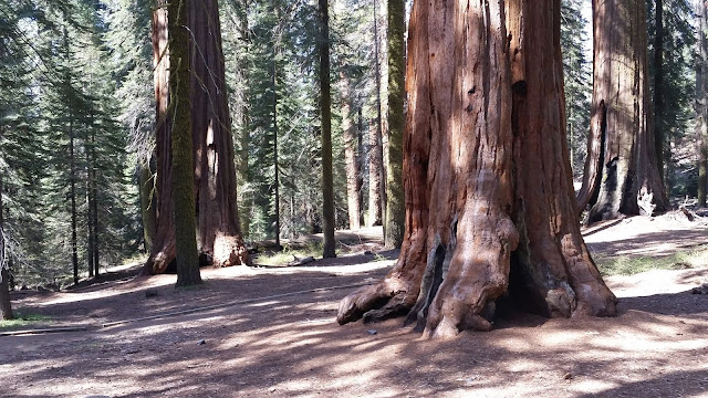
On our drive from our campground at Shaver Lake to Wishon Reservoir we made a stop to visit these wonderful Giant Sequoia Redwood Trees at McKinley Grove Big Trees.  The largest tree is 20.3 feet in diameter!


Huntington Lake - Fresno County, California


Visited on 5/19/2018, Jeff and our two chocolate Labradors, Summer and Skye joined me on a business trip to give Drinking Water examinations in the Central Valley of California.  We traveled in the Central Valley foothills northeast of Fresno up to Huntington Lake above our camping spot at Shaver Lake.  Huntington Lake is a reservoir in Fresno County, California on Big Creek, located in the Sierra Nevada at an elevation 6,955 feet.  This is a beautiful peaceful lake with several smaller streams that flow into the lake and it receives additional water from the underground tunnels of Southern California Edison's Big Creek hydroelectric project. Water from the lake flows into Big Creek, but some is diverted by underground tunnels to the Eastwood Powerhouse, which discharges into Shaver Lake.

Huntington Lake was constructed in 1912 as a part of the enormous Big Creek Hydroelectric Project envisioned by John S. Eastwood to provide power for a growing California. The lake was named for Henry Edwards Huntington, the railroad magnate who financed the earliest work to develop the Big Creek project which includes a system of lakes, tunnels, steel penstocks and power houses.
Four dams form the lake, which has a surface area of 1,441 acres. There were originally three dams, completed in 1913, but a fourth dam, completed in 1919, was built to increase the lake's capacity. The other three dams were raised and covered with concrete.
 
On December 6, 1943, a B-24 bomber with six men aboard crashed into Huntington Lake. The crew had taken off from nearby Hammer Field in Fresno, California to search for a second B-24 which had disappeared a day earlier during a night training flight. Two members of the original eight man crew, a radio operator and the co-pilot, bailed out of the troubled plane and survived. Some have speculated that the pilot may have mistaken the lake for a sierra meadow and tried to make an emergency landing during a snow storm. The wreckage of the plane, and the remains of its crew were discovered by a survey team in August 1955, when the lake had been drained for dam repairs. The original B-24 they had been searching for was discovered in July 1960 in Hester Lake, a small body of water in a remote area not far from Huntington. Neither plane has been recovered.


The Town of Big Creek, California

Shaver Lake - Fresno County, California


Visited on 5/19/2018, Jeff and our two chocolate Labradors, Summer and Skye joined me on a business trip to give Drinking Water examinations in the Central Valley of California.  We traveled in the Central Valley foothills northeast of Fresno to an elevation of 5,500 feet above sea level to Shaver Lake.  We camped at the Dorabelle Campgrounds on the southwest side of the lake.  Shaver Lake is an artificial lake on Stevenson Creek, in the Sierra National Forest of Fresno County, California. Several smaller streams also flow into the lake, and it receives water from the underground tunnels of Southern California Edison's Big Creek Hydroelectric Project.  The small town Shaver Lake is located on its south-west shore.

The lake was formed with the construction of Shaver Lake Dam, which was built by Southern California Edison and completed in 1927. The 180-foot dam was built in 50-foot blocks, with a keyway to hold it in place and a 75-centimeter copper sheet to make it watertight. The lake is 2,177 acres in size. Some water from the lake is discharged into Stevenson Creek for fish and other wildlife, but the rest is diverted to Big Creek, where it powers several hydroelectric plants in succession.

The area now covered by the lake was extensively logged before the dam was built, and an extensive log flume system several miles long was constructed to bring logs down the mountain. The town to this day maintains a nostalgic logging theme. Several buildings in town are in fact old, converted sawmills. Adjacent to the lake is Camp Edison, built and operated by Southern California Edison. 
The reality TV shows Endurance High Sierras and Capture were filmed at Shaver Lake in summer 2006 and summer 2013, respectively.


Millerton Lake - Fresno County, California


Visited on 5/18/2018, Jeff and our two chocolate Labradors, Summer and Skye joined me on a business trip to give Drinking Water examinations in the Central Valley of California.  We traveled in the Central Valley foothills north of Fresno to an elevation of 561 feet above sea level to Millerton Lake.  We camped at the Fort Miller Campgrounds at campsites #52 and we decided since site #53 had the best picnic area we got them both.  All of the campgrounds are located on the north side of the lake.  Millerton Lake is a 4,900 acre artificial lake near the town of Friant about 15 miles north of downtown Fresno. The reservoir was created by the construction of Friant Dam on the San Joaquin River which, with the lake, serves as much of the county line between Fresno County to the south and Madera County to the north.

Part of the Central Valley Project, the dam was built by the United States Bureau of Reclamation (USBR) and was completed in 1942. The lake stores water for irrigation, which is distributed by the Madera and Friant-Kern Canals to the San Joaquin Valley.
Secondary uses include flood control and recreation, including swimming, fishing, water skiing and camping. A 25 MW hydroelectric plant operated by the Friant Power Authority produces electricity from large releases and two smaller plants use water released for a fish hatchery and to maintain minimum-flow in the river.

Prior to the construction of Friant Dam, the current lake bed was the site of the town of Millerton, the first county seat of Fresno County.  By diverting most of the San Joaquin River for irrigation, the Friant Dam has caused about 60 miles of the river to run dry except in high water years when floodwaters are spilled from the dam.


Camp sites #52 & #53 have an awesome view of the lake from both the parking spot and the picnic areas.


Pine Flat Reservoir - Fresno County, California


Visited on 5/17/2018, Jeff and our two Chocolate Labradors, Summer and Skye joined me on a business trip to give Drinking Water examinations in the Central Valley of California.  We traveled in the Central Valley foothills east of Fresno to an elevation of 961 feet above sea level to Pine Flat Lake.  We stayed in the Island Park Campground Site #49 with a view of the boat ramp and some of the lake.  Next time we want to camp right on the lake at campsite #30.  Pine Flat Lake rests among beautiful oak and pine covered hills.  Pine Flat has a shoreline that is 20 miles long and the lake was completely full of water.  This reservoir is located in the Sierra Nevada foothills of eastern Fresno County, California on the western north-south border to the Sierra- and Sequoia National Forests, about 30 miles east of Fresno. The lake is managed by the U.S. Army Corps of Engineers (USACE) and is open to boaters, campers & hikers.

The lake was formed by the construction of Pine Flat Dam on the Kings River in 1954 by the U.S. Army Corps of Engineers, and is a large reservoir that totals 5,970 acres in size.  Although primarily designed for flood control, the project also provides for irrigation and groundwater recharge, recreation, and with the completion in 1984 of the Jeff L. Taylor Pine Flat Power Plant, generation of hydroelectric power.


Avocado Lake - Fresno County, California


Visited on 5/17/2018, Jeff and our two Chocolate Labradors, Summer and Skye joined me on a business trip to give Drinking Water examinations in the Central Valley of California.  We traveled in the Central Valley foothills east of Fresno to an elevation of 499 feet above sea level on our way up to Pine Flat Lake for a couple nights of camping.  Avocado Lake is a lake located just 9.7 miles from Squaw Valley, in Fresno County, near the small town of Avocado, CA.  It is an 83 acre lake that is on the Kings River below Pine Flat Dam.  The 210 acre park owned and managed by the County of Fresno has a very nice scenic picnic area, but no campgrounds are on site.

Big Dry Creek Reservoir - Fresno County, California


Visited on 5/19/2018, Jeff and our two chocolate Labradors, Summer and Skye joined me on a business trip to give Drinking Water examinations in the Central Valley of California.  After completing examinations in Fresno and on my way to meet Jeff and the dogs up at Shaver Lake, I traveled from Fresno to the Central Valley foothills northeast of Fresno to the Big Dry Creek Dam and Reservoir which is a flood control facility located on Dry Creek in Fresno County, near the community of Clovis, about 15 miles northeast of Fresno.  The dam and reservoir also span smaller drainages immediately to the north of Dry Creek. Downstream of the dam, Dry Creek continues on to the southwest, passing through Fresno, for a distance of about 18 miles before it becomes the Dry Creek Canal, which services areas to the southwest of Fresno.  On the day I visited there was very little water in the basin.

In order to get to a spot where I could get a good picture I hiked up the Dam Road which was restricted from vehicle use and No Trespassing signs were everywhere.  The facilities are operated by the Fresno Metropolitan Flood Control District, which makes controlled releases of flood runoff to downstream infiltration basins. This reservoir and Big Dry Creek Dam was constructed 1948 by the United States Army Corps of Engineers (Corps), turned over to the California State Reclamation Board, and finally transferred to Fresno County.  It is currently owned and operated by FMFCD.  The district operates the project to make beneficial use of flood runoff by controlled releases to infiltration basins.

Big Dry Creek Dam was originally constructed with a crest at an elevation of 435 feet above sea level.  In 1993, the dam crest was raised to elevation 442.2 feet.  The size of the reservoir if full would be 2,151 acre feet.

In to access the Reservoir I had to hike up on an access road past several No Trespassing signs posted by the Fresno Metropolitan Flood Control District.  I hate trespassing, but I had to get a picture of the reservoir water!

Balsam Forebay - Fresno County, California


Visited on 5/19/2018, Jeff and our two chocolate Labradors, Summer and Skye joined me on a business trip to give Drinking Water examinations in the Central Valley of California.  We traveled in the Central Valley foothills northeast of Fresno up to Huntington Lake above our camping spot at Shaver Lake.  Balsam Forebay is a 60 acre artificial lake located at an elevation of 6,800 feet above sea level in the Sierra National Forest of Fresno County, California near California State Route 168 approximately 5 km north east of Shaver Lake. A trail provides public access to and around the forebay with access to from the southeast shore. Road access is limited to official vehicles. The area is popular for hiking, swimming, and a picnicking.  Jeff and I unleased the dogs and went on the .5 mile hike to the Forebay.  The trail is well marked and it is quite a pleasant stroll through the alpine forest, we highly recommend it.

The lake is formed by the Balsam Meadow Dam, a rockfill dam completed in 1986. The dam is 1,325 feet  long and 127 feet high, with 4.1 feet of freeboard. Southern California Edison owns the dam.  We visited on a Saturday afternoon and there was only one other couple with their dog on the trail and at the Lake.  The lake is small, but very beautiful and there are several picnic tables and a comfort station located at the Lake on the east side of the lake.


During our hike to the Balsam Forebay we noticed this interesting little flower blooming up from the pine needles on the ground.

Nice little hike from the parking lot to the Balsam Forebay.

Bass Lake - Madera County, California


Visited on 5/18/2018, Jeff and our two chocolate Labradors, Summer and Skye joined me on a business trip to give Drinking Water examinations in the Central Valley of California.  We went for an afternoon drive from our camping spot at Millerton Lake over to Bass Lake to the north through country roads.  It was a nice drive to the north over to Bass Lake.  Bass Lake is elevation of 3,465 feet above sea level and the lake is 1,165 acres.  Bass Lake is located in the Sierra National Forest, of Madera County, California, approximately 14 miles south of the entrance to Yosemite National Park. The lake is approximately four miles long and one-half mile wide.

The lake is formed by the construction of the Crane Valley Dam across Willow Creek, a tributary to the San Joaquin River, and is referenced as Crane Valley Lake.  Releases from the dam drive the hydro-electric powerplant operated by Pacific Gas and Electric Company. The 145 feet concrete gravity dam was completed in 1910 by Pacific Gas and Electric.
Most of the land around the lake is part of the Sierra National Forest. The U.S. Forest Service designated the lake an official Recreation Area and has developed campgrounds and picnic areas on the south shore of the lake. The north shore of the lake is primarily made up of private cabins and homes of the unincorporated community, Bass Lake, California, with a year-round population of 2,195.

In 1963, Bass Lake became a yearly destination for the Hells Angels Motorcycle Club (HAMC), attracting hundreds of bikers from across the state. A first-hand report of the 1965 Bass Lake Run was reported by Hunter S. Thompson in his first book, Hells Angels: The Strange and Terrible Saga.
Most locals viewed the run as an annual menace that brought crime and frightened tourists away. Each year roadblocks, curfews, and campground restrictions were enforced by law enforcement from throughout Madera County and its surrounding areas in an effort to block, or at least control, the Hells Angels activity.  The run peaked in the 1970s before slowly fading away altogether by the late 1980s.