Monday, December 11, 2017

Lake Kaweath - Tulare County, California


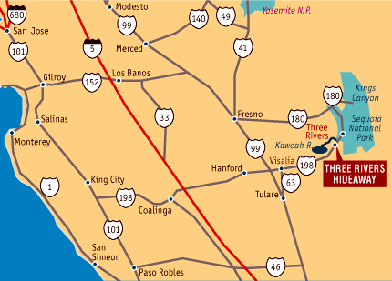
Visited on 11/17/2017 driving along the Central Valley foothills after proctoring Drinking Water operator examinations at Mountain Home Conservation Camp near Porterville, CA.  This 1,945 acre lake was created by the construction of the Terminus Dam in 1962 at an elevation of 255 feet above sea level.  This lake is located along Highway 198 east of Visalia near the town of Three Rivers, CA just 15 miles west of the entrance to Sequoia and Kings Canyon National Parks.  The Terminus River flows out of Sequoia National Park into and out of the lake.  Water level shown in my picture is low due to the time of year being late fall (November) and the winter rains had not started.

Sunday, December 10, 2017

Lake Santa Margarita - San Luis Obispo County, California


Visited on 10/15/2017 with Jeff and our dogs on a weekend camping trip at Avila Beach, south of San Luis Obispo, CA.  We took a nice Sunday afternoon drive up to Lake Santa Margarita which is a 793 acre lake in the Central Coast hills just southeast of the town of Santa Margarita.  This lake is located at 1,306 feet above sea level.  Created by the construction of the Salinas Dam in 1941, Santa Margarita Lake was originally designed to furnish water to Camp San Luis Obispo. Today, swimming in the lake is not permitted as it is the drinking water reservoir for the City of San Luis Obispo.

Beyond the developed area of the park, Santa Margarita Lake Natural Area represents several thousand acres of designated open space. This section of the park is managed for its natural resource values, passive recreational use, and environmental education opportunities. The area is accessible to hikers, bicyclists and equestrians. Motor vehicles are not permitted in the Natural Area. Santa Margarita Lake is a nature lover’s retreat. With thousands of acres of unspoiled open space, the park is home to countless species of plants and wildlife making it the perfect location for nature study, boating, and fishing. 

We had a great time driving around the lake and the dogs chased a couple of ducks near the boat launch area when we stopped for Jeff to take a swing in the kiddy park on the shoreline.  But, since this lake is a drinking water source for the City of San Luis Obispo, no dogs are allowed to swim in the lake.  It was still a nice drive and it was a great getaway and is very peaceful.


Whale Rock Reservoir - San Luis Obispo County, California


Visited on 10/12/2017 traveling to the Central Coast of California to join Jeff and our dogs on a camping trip at Avila Beach, south of San Luis Obispo, CA.  Whale Rock Reservoir is a 594 acre lake with the only ocean view I know of on the pacific ocean!  This lake is located at 150 feet above sea level just a couple of miles northeast of the ocean side city of Cayucos, California just north of Morro Bay, California.  Whale Rock Reservoir has a great trail alongside the lake which is primarily used as a fishing access, but is also a beautiful area for hiking and picnicking. The Whale Rock Dam was built in 1961, creating this 1350-acre reservoir. It is a domestic water supply used as a source of drinking water. The lake is fed from Old Creek and Cottontail Creek at the two northern points. The lake is surrounded by grassy rolling hills.


Castle Lake - Siskiyou County, California


Jeff and I visited Castle Lake on our way up to Oregon to view the Solar Eclipse in totality on a week long camping trip in our camper/truck with our dogs, Summer and Skye.  Castle Lake has very crystal clear water, however very small at only 47 acres and located at an elevation of 6,050.  This is a very beautiful lake located just southwest of the town of Lake Shasta City in northern California at the southwest base of Mount Shasta off of Interstate 5.  Castle Lake is a alpine lake and lots of historical data has been studied by the University of Davis.  This Lake has a lot of history and I have listed some of the information on this special lake below.

The lake is usually reached by driving along an approximately 7 mile road from Lake Siskiyou. About 3 miles from the lake, along this road, are Ney Springs and Faery Falls. Ney Springs is the site of the historic Ney Springs Resort, a late 19th-century resort based on the mineral springs there; this resort was one of a number of such popular resorts in Siskiyou County, including Upper Soda Springs, and Shasta Springs.  A short hiking trail leads to nearby Faery Falls, where Ney Springs Creek falls nearly 60 feet down a granite cliff face, forming a clear pool at the bottom.

About one-quarter mile north of Castle Lake is a campground with 6 first-come, first-served campsites. At the lake itself, fishing and picnicking, as well as viewing the local plant life, wildlife and scenery, are common activities. The lake waters can be cool, so swimming is generally limited to summer months. Kayaking, rowboating and rafting are available on the lake. In the winter, in addition to cross-country skiing and snow-shoeing along the trails in the area, the lake will ice over and ice fishing is a common activity.
From the parking area at the lake, a half-mile (1 km) trail winds along the northern and western shore of the lake, ending at the granite face of the headwall, which forms the southern shore. Along the way, hikers will pass the Castle Lake Limnological Research Station.

Following the eastern shore, the Little Castle Lake Trail leaves the parking area, and then climbs the adjoining ridge; about 1 mile along this trail is Little Castle Lake, a small glacial tarn reached by passing through meadows of wild flowers in the early summer. Little Castle Lake is within the Castle Crags Wilderness Area. Heart Lake, another small tarn, located above the headwall of Castle Lake, may also be reached via an informal cut-off from the Little Castle Lake Trail.
At this point, the well-known Pacific Crest National Scenic Trail is one-half mile away, just over the Trinity Divide. The Pacific Crest National Scenic Trail stretches from Mexico to Canada, following the highest portion of the Sierra Nevada, Klamath Mountains, and Cascade Range and paralleling the Pacific Ocean by 100 to 150 miles.
The Little Castle Lake Trail continues on to Mt. Bradley, a locally prominent mountain with views of Mount Shasta, overlooking Dunsmuir, California and the canyon of the Upper Sacramento River. Along the way, the trail joins with a network of connections leading into Castle Crags State Park.
 
The lake's origins date to the Pleistocene Era (more than 10,000 years ago) when a glacier carved a basin in the location of the current lake. During that era, much of North America was glaciated.  Castle Lake is a typical glacier cirque lake (or tarn), reaching depths of up to 110 feet near the southern, granitic part of the lakeshore (the cirque face). There is a terminal moraine of boulders and gravel forming a natural dam opposite the cirque face along the northeastern shore of the lake, where there is an outlet, and the lake is 10 to 15 feet deep.

The cirque where Castle Lake is found is a classic Northern Hemisphere cirque. The cirque headwall (the highest part of the mountain where the glacier began to form) was in the south or southwest, and the part of the mountain that sloped downward to the northeast was away from the prevailing winds. The resulting shaded area was sheltered from direct sun, and from the evaporating effects of wind. These conditions encouraged snow which had fallen in the winter to remain throughout the summer and fall, creating a year-round snow pack which grew deeper each year.

During initial glacial formation, snow changed into glacial ice as this year-round snow pack increased and deepened. The process of nivation followed (where a hollow in a slope was enlarged by freeze-thaw weathering and glacial erosion). As the hollow enlarged and filled with snow and ice, rock debris (or till) contained within the glacial ice also began to abrade the bedrock surface – as the glacial ice moved down the slope, it had a "sandpaper effect" on the bedrock which it scraped.


Formation of cirque and resulting tarn.
Eventually the hollow took the shape of a large bowl in the side of the mountain, with the headwall being weathered by constant freezing and thawing, and eroded by plucking. The basin became deeper (especially at the base of the headwall) as it continued to be eroded by abrasion.  When the current warming period began, the glacier retreated and finally melted completely. It left behind a bowl shape, deepest at the base of the headwall where the glacial ice had been the deepest and most abrasive. The bowl shape extended to its northeast edge, where there was a terminal moraine of smaller rocks and debris which had been deposited by the glacier. When the bowl-shaped crater filled with water, this terminal moraine acted as a natural dam, helping to contain the water in the newly formed cirque lake.
 
Castle Lake was within the range of the Okwanuchu tribe, one of a number of small Shastan-speaking tribes of Native Americans who were closely related to the adjacent larger Shasta tribe.  The Okwanuchu occupied territory near Mount Shasta, including the nearby present-day cities of Mount Shasta and Dunsmuir, California, and the upper Sacramento River canyon (among other areas). The Okwanuchu were speakers of the older Hokan-speaking family of languages, with archaeological sites associated with their range dating back more than 5000 years. However, members of a tribe of the Penutian-speaking family of languages, the Wintu, who arrived in central Northern California about 1200 years ago, were out-competing their Hokan-language family neighbors, and were expanding Wintu territory.  It is unclear at the time of first contact with non-Native Americans in the 1820s which tribe was living nearest to Castle Lake. Little or no information is available about Native American use or beliefs regarding Castle Lake; for example, Castle Lake is not mentioned in a published collection of Wintu tales and legends.

The first non-Native Americans to pass through the area of Castle Lake were hunters and trappers of the Hudson's Bay Company, who began to come down the Siskiyou Trail from present-day Washington into Mexican-controlled California, in the late 1820s and early 1830s, in search of beaver and other pelt-bearing animals. At about this same time, Ewing Young led the first group of Americans up the Siskiyou Trail, passing near Castle Lake.  In 1841, an overland party of the United States Exploring Expedition, the first cartographers and scientists came through the area.   Following the annexation of California by the United States in 1848 as a result of the Mexican-American War, Castle Lake came under the control of the U.S. Federal Government as public land.
In 1855, an area near Castle Lake, now known as Battle Rock, was the site of a battle between Native Americans and California Gold Rush-era settlers. The poet Joaquin Miller wrote a first-hand account of this battle, The Battle of Castle Crags, in which Miller took part in the fight, and received an arrow wound through the cheek and jaw. This battle was reportedly the last battle between Native Americans and settlers in which the Native Americans fought exclusively with bow and arrow.

With the development, first, of the U.S. "Forest Reserve" system in the late 19th century, and then the organization of the U.S. National Forests in the early 20th century, Castle Lake came under the stewardship of the U.S. Forest Service. The association between U.C. Davis and Castle Lake began in 1957, with the first extensive study done of the lake, followed by the construction of the "Castle Lake Limnological Research Station".


Scotts Flat Reservoir - Nevada County, California


Visited on 12/8/2017 while traveling north of Nevada City, CA to proctor drinking water examinations at Washington Ridge Conservation Camp.  Scotts Flat Reservoir is located in the Tahoe National Forest off of Highway 20 just a 6.5 miles northeast of Nevada City in the foothills at an elevation of 3,069 feet above sea level.  The beautiful scenic lake is 725 acres in size and was formed back in 1948 with the construction of the Scotts Flat Dam across Deer Creek.  Jeff and I went horseback camping at the nearby Spillman Horse Camp with our good friend Merlin Jackson a couple years ago, which is located just about five miles up Highway 20 from this lake. 


Wednesday, November 29, 2017

Lake Nacimiento - San Luis Obispo County, California


Visited on 10/12/2017 while traveling to Avila Beach to join Jeff and the dogs on a weekend camping trip on the beach.  Lake Nacimiento is an 18-mile long lake on the Nacimiento River in northern San Luis Obispo County, California. The lake contains many arms including Snake Creek and Dip Creek, nearer the dam, and the central Las Tablas and Franklin Creeks. Because of the dragon-like shape created by the positions of these arms, it is sometimes referred to as Dragon Lake. The lake can fill quickly in the winter from river surges resulting from downpours upstream in the Santa Lucia Range so the level is not usually allowed to capacity until May 1 of each year.  
Lake Nacimiento has a low fish population due to the high levels of mercury present in the lake, due to runoff from the closed Klau and Buena Vista Mercury Mines, south of the lake. Only a few fisherman manage to catch fish. Consumption of bass, crappies, carps, and catfish from the lake is dangerous, but blue gill and sucker fish may be eaten only once per week safely. The lake is unique among California reservoirs in that it contains, among other species, introduced white bass, which thrive in the lake and spawn in the river and inflowing creeks in spring. In fact, the world fly fishing record for a white bass was broken in 1981 at Lake Nacimiento. The fish was caught by Cory Wells, a member of the world famous musical group, Three Dog Night. The record stood for over 27 years. Lake Nacimiento can also produce power from a turbine at the base of the dam.
Lake Nacimiento is also a haven for watersport enthusiasts. The lake provides ample room for waterskiing, wakeboarding, jetskiing, wakesurfing, and other water-related activities.
The lake was originally designed for irrigation water and flood control as well as recreation. Nacimiento Dam, a 210-foot earthfilled dam, forms the lake. The dam was built by the Monterey County Water Authority under Monterey County District Engineer Loran Bunte Jr, which completed construction in 1956.  The water authority uses the lake to recharge its groundwater. Even though the lake is entirely inside San Luis Obispo County, the waters are patrolled by the Monterey County Parks Department under a joint powers agreement with San Luis Obispo County. The Monterey County Parks Department’s primary jurisdiction is the lake waters, up to the high water mark and the resort area. The San Luis Obispo County Sheriff’s Office does have a boat at the lake for access to the back country around the lake. Also, they have been known to write tickets on the water. Lake Nacimiento has a capacity of 377,000 acre feet. The lake is near the city of Paso Robles. The lake is also the home of two residential housing developments, which lie on the lake's shore; Heritage Ranch and Oak Shores. There are several smaller (10-40 house) private subdivisions on the south west side of the lake. These houses were affected by the Chimney Fire in August 2016. Except for the resort area near the dam, most of the property around the lake is private. Overnight camping on the lake, outside of the resort, is not allowed. Also, you are considered trespassing if you set up or venture on land above the high water mark.
The lake was developed and paid for by Monterey County. However San Luis Obispo County retained the rights to 17,500 acre feet of water per year. This was not requested by San Luis Obispo County until the mid-2000s. In October 2007, construction started on a pipeline to bring water from the lake to Paso Robles, Templeton, Atascadero, and San Luis Obispo. During construction, three people were killed—one run over by a dump truck, and two drowned when an excavator hit an unrelated water pipeline which flooded a section of water project pipe under construction. The project went online in January 2011.
The Lake's dam was shut down during 2014 due to damage that occurred to one of the turbines, and as a result the neighboring Lake San Antonio was emptied to critical levels to supply the Salinas Valley with groundwater. The Lakes levels have dropped significantly due to the recent drought conditions in California.


Lake San Antonio - Monterey & San Luis Obispo Counties, California

  
Visited on 10/12/17 while traveling to the Central Coast of California to join Jeff and our dogs for a camping trip at Avila Beach, south of San Luis Obispo, CA.  Lake San Antonio is a lake located primarily in southern Monterey County, California, and partially in northern San Luis Obispo County, California. The lake is formed by San Antonio Dam on the San Antonio River. The dam is 202 feet tall and was completed in 1965.  The lake and dam are owned by the Monterey County Water Authority. The lake is 5,720 acres at an elevation of 781 feet above sea level and has a capacity of 350,000 acre feet.   
Lake San Antonio's primary purpose is to provide groundwater. Without the lake, the San Antonio River would be nearly dry in the summer months. With water in the river year-round, more of it can seep into the ground.  
Most of the lake has dried in recent years. The 2014 Wildflower Triathlon had to accommodate the extremely low water level by moving the swim portion two miles from where it is traditionally held. Participants that year had to run along the former lake bed to get to their bike transition area.

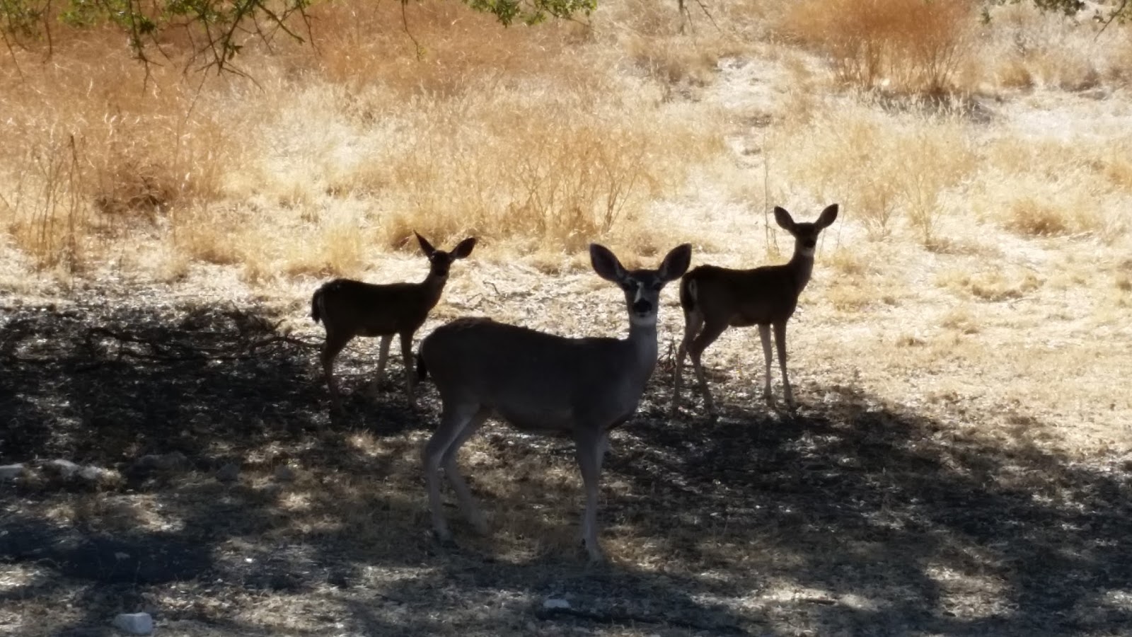
As I drove along the lake shoreline there were several deer and they stopped to watch me and we had a "stare-off"!
 
 
I was surprised to see this sign at the Lake shoreline beach and picnic area to watch out for Wild Hogs, but I guess they have had some sightings of wild hogs that savage for food and trash left behind by campers and picnickers!