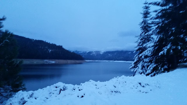
Visited 01/21/2018 – Jeff and I loaded up our two dogs, Summer and Skye and took a nice Sunday drive up to the Sierra Foothills in our Jeep Wrangler. Just above Sugar Pine Reservoir we encountered lots of snow from the recent storms. Even though we did not have chains, we kicked it into 4 wheel drive and did just fine navigating the snow packed roads. Our final destination, French Meadows Reservoir was hard to get to and after a very long drive on 33 miles of Mosquito Ridge Road twisting and turning along the canyon wall road we finally made it to this beautiful reservoir right before sunset around 5 pm. We found this beautiful, peaceful lake with it's shoreline covered in snow. French Meadows Reservoir is a 1,344 acre manmade lake 36 miles northeast of Foresthill, California on the Middle Fork of the American River. The reservoir is 2.9 miles long, 0.6-mile wide, with 7.3 miles of shoreline.
Tahoe National Forest manages the recreational facilities which include five campgrounds, two group campgrounds and two paved boat launch ramps. Activities at the lake include powerboating, kayaking, canoeing, fishing, picnicking and hiking. The reservoir is entirely within a state game refuge so no firearms, pellet guns or archery weapons are allowed. The elevation of the lake is 5,263 feet and is nine miles from the crest of the Sierra Nevada Mountain Range.
The reservoir was built in December 1964 with the construction on the Middle Fork of the American River of the L.L. Anderson Dam. The dam is rock-fill with earth core. French Meadows Reservoir is part of the Middle Fork Project for hydroelectric power generation and most of its water is diverted to the French Meadows Powerhouse, located along the north shore of Hell Hole Reservoir, by an underground tunnel. Releases from French Meadows Reservoir to the powerhouse began one year later, December 13, 1965. A minimal "fish flow" is released into the natural waterway of the Middle Fork American river for fish and wildlife habitat considerations. The project is operated by the Placer County Water Agency.
On the way up Mosquito Ridge Road we stopped in the middle of a bridge and took this beautiful picture of this snow covered creek. I did not alter the picture, it almost looks like it was a black and white photo, but it is actually around 5 pm in the evening and the fog was just hovering above us. Picture perfect, Christmas card collection!


No comments:
Post a Comment