Monday, July 31, 2017

New Spicer Meadow Reservoir - Tuolumne County, California


Visited 7/29/2017 - Jeff and I with our two chocolate Labradors, Summer and Skye arrived at New Spicer Meadow Reservoir late in the afternoon after a full day of capturing the beauty of several California Lakes in the High Sierra Mountains. 

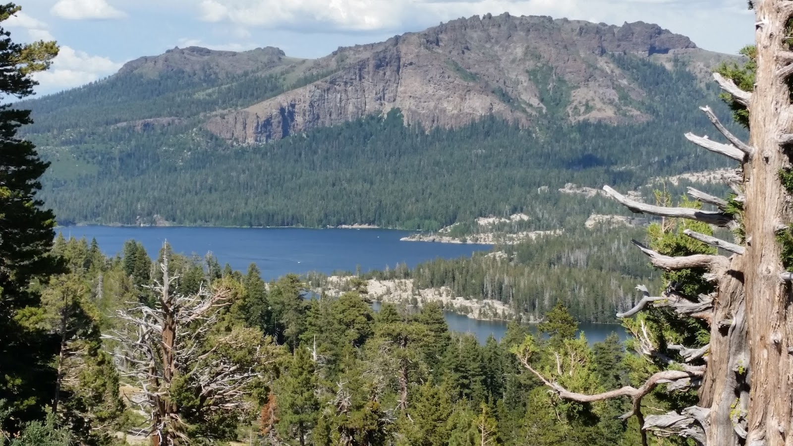
New Spicer Meadow Dam on Highland Creek, a tributary of the Stanislaus River. The 265-foot tall dam is composed of rock-fill and was completed in 1989. Additional water is diverted from the North Fork of the Stanislaus River by the North Fork Diversion Dam and a two-mile tunnel.  Downstream from the dam and reservoir, the water continues flowing in Highland Creek until its confluence with the North Fork of the Stanislaus River.  Calaveras County Water District owns the dam. Water from the reservoir supplies drinking water and water for recreation and irrigation. Also, along with the Northern California Power Agency, the water district sells electricity from the 5.5-MW hydroelectric plant at the base of the dam. This Reservoir is located off Highway 4 southeast of Calaveras Big Trees State Park and 50 miles southeast of Angels Camp, California at elevation 6,400 feet above sea level. This 1,998 acre lake was calm and had minimal boats and visitors.  This would be a great location to come back and enjoy more time at this nice lake. 


We enjoyed running the dogs on the rocks and beach on the north side of the lake between the boat launch and the dam.  The water level looks like it was higher earlier this year, but has since receded a little.

Mosquito Lakes - Alpine County, California


Visited 7/29/2017 - Jeff and I loaded up our two chocolate Labradors, Summer and Skye and set out in our Jeep Wrangler for a full day of capturing the beauty of several California Lakes.  When we came up on these two Lakes we said, "Wow!  How beautiful - what a hidden gem."  A few people were fishing on the left side of the road into the lake and so peaceful.  Mosquito Lakes is located near Ebbett's Pass along Highway 4 at elevation 8,040 feet above sea level.  These two shallow, reflective alpine lakes are especially popular with photographers and anglers who enjoy fishing for trout from the rocky shoreline. When conditions are just right and the winds are calm, the lakes turn into a glassy mirror-like surface, reflecting the blue sky, tall trees, granite boulders and picturesque summer cabins on the south shore of the lake. The two lakes drain into different watersheds—the western one into the North Fork Stanislaus River, the eastern into Pacific Creek and then into the North Fork Mokelumne River. There are two small U.S. Forest Service campgrounds at Mosquito Lakes, and some sites are on the actual historic Emigrant Trail.  In the 1920s the Angels Camp Booster Club was looking for a site in the mountains for their “high jinks,” so Angels Camp druggist Harry Barden, dentist Charles Smith and wife Amelia, Dick Raggio, and others settled on Mosquito Lakes. Named “Camp Kilkare,” at that time the lakes were just shallow snowmelt lakes filled with mosquitoes. When the highway department realigned the old turnpike closer to the lake, Harry Barden and his cronies constructed a concrete dam between the lakes, raising them for swimming and fishing. A segment of the original Emigrant Road can be seen north of the present route. Immediately east of Mosquito Lakes is Pacific Summit, known as the “Second Summit” on the Big Tree-Carson Valley Turnpike. The 5,000-foot level was called the “First Summit” and Ebbetts Pass, the “Third Summit.” A spectacular view of the U-shaped Pacific Valley is visible below the summit, as are Raymond and Reynolds Peaks to the northeast. Another pull-out on the way to Pacific Valley offers a view north toward the Carson Pass area and Jeff Davis Peak and a geologic featured called the Nipple.


Red Lake - Alpine County, California


Visited 7/29/2017 - Jeff and I loaded up our two chocolate Labradors, Summer and Skye and set out in our Jeep Wrangler for a full day of capturing the beauty of several California Lakes.  Several folks were camped around the lake for the day, just relaxing and a few fisherman with lines in the water.  While we were there one guy pulled out a nice sized brook trout on his line and was smiling from ear to ear!

Red Lake is an 85 surface acre reservoir in Alpine County that is situated at approximately 7,861 feet above sea level. It is located off Highway 88, roughly one mile south of the Carson Pass and about 25 miles south of Lake Tahoe. Red Lake drains into Red Lake Creek, which is a five mile creek that flows into the West Fork Carson River.


Just above Red Lake is Red Lake Peak at an elevation of 10,068 feet above sea level and is believed to be the vantage point from which John C. Fremont and Charles Preuss made the first recorded sighting of Lake Tahoe in February 1844 as Fremont's exploratory expedition made a desperate crossing of the Sierra Nevada through what is now Carson Pass on their way to obtain provisions at Sutter's Fort in Sacramento. The peak lies just north of the pass and generally northwest of the Red lake east of the pass for which the peak is named.  Lake Tahoe is visible to the north from the peak.

Red Lake is part of the Red Lake Wildlife Area which is a total of 860 acres and managed by the California Department Fish and Wildlife. The vegetation surrounding Red Lake is characteristic of red-fir and lodgepole-fir forest. Open slopes are dominated by sagebrush with bitterbrush and serviceberry. Forestdale Creek and the other drainages around Red Lake are lined with willows and aspen groves. Common wildlife species include deer, coyote, jackrabbit, quail, flicker, warblers, red-tailed hawk, golden eagle, golden-mantled ground squirrel, marmot, and beaver. Fish species in Red Lake consist of brook trout and suckers; Forestdale Creek contains rainbow and brook trout.  Red Lake is open all year to the public with a five trout bag limit with 10 in possession.

Red Lake has been annually stocked since 1968 by the California Department of Fish and Wildlife for recreational fishing.  Historically, Red Lake was a brook trout fishery, however in 2011 CDFW shifted the fishery to native Lahontan cuttthroat trout.


Kinney Lake - Alpine County, California


Visited 7/29/2017 - Jeff and I loaded up our two chocolate Labradors, Summer and Skye and set out in our Jeep Wrangler for a full day of capturing the beauty of several California Lakes.  Kinney Lake is one of Jeff and my favorite lakes in one of my favorite counties in California.  It is so absolutely beautiful and is so peaceful and a lot of great hiking and unrestricted camping in the area.  It is located near Ebbetts Pass along Highway 4 northeast of Markleeville, California.  At an elevation of  8,533 feet above sea level this lake is a popular fishing spot for brook, rainbow, and cutthroat trout, as well as providing spectacular views from the trails connecting the reservoir, lakes, and Ebbetts Pass.  History of this area runs deep.... The lakes are depicted as Silver Lakes on an 1864 map of the Silver Mountain Mining District, with the Mountain Oaks Mine located between them. In the 1890s, the Alpine Land & Reservoir Company, an organization of East Fork Carson River farmers in Douglas County, Nevada, dammed a tributary of Silver Creek to create Upper and Lower Kinney Lakes, as well as Kinney Reservoir. Utilized for irrigation purposes in the Carson Valley, by 1912 the agriculturalists had constructed half a dozen reservoirs in Alpine County. Lower Kinney Lake Dam was completed in 1926, and Upper Kinney Lake Dam in 1990.


Caples Lake - Alpine County, California


Visited 7/29/2017 - Jeff and I loaded up our two chocolate Labradors, Summer and Skye and set out in our Jeep Wrangler for a full day of capturing the beauty of several California Lakes.  Caples Lake is one of my favorite lakes in one of my favorite counties in California.  It is absolutely beautiful and is so peaceful.  It is located on Highway 88 located near Kirkwood Ski Resort 62 miles east of Jackson, California and only 15 miles from Lake Tahoe.  At an elevation of  7,806 feet above sea level this lake is 620 acres. Caples Lake lies in the Carson Pass area with panoramic views, this lovely alpine lake in the Sierras is in the Eldorado National Forest and is very isolated from the crowds.  The lake was named for Dr. James Caples, a pioneer to the gold country, who moved here in 1849, establishing a ranch and trading post on the north side of the lake, which he ran for 30 years.  I walked out to the end of the boat dock to snap a few camera shots.  I just love the way the snow capped peaks accent the lake.


Silver Lake - Amador County, California


Visited 7/29/2017 - Jeff and I loaded up our two chocolate Labradors, Summer and Skye and set out in our Jeep Wrangler for a full day of capturing the beauty of several California Lakes.  Silver Lake is a very picture perfect alpine lake on Highway 88 located near Kirkwood Ski Resort 52 miles east of Jackson, California.  At an elevation of  7,200 feet above sea level this lake is 385 acres. With a lot of history Silver Lake has been a popular destination on Carson Pass for decades. Residents of the central valley flocked to the mild climates of the mountains in the summer, often setting up tent camps that stood for months. Many of the lodges and camps at Silver Lake were established in the 1920s, while Plasse's dates back to 1853. Several of the old resorts still operate today, offering modernized accommodations and countless amenities. Anglers, hikers, photographers, artists, birdwatchers, and nature lovers enjoy exploring the lake and its surrounding countryside.


This monument is posted at the Vista Lookout Point at Silver Lake regarding the Mormon-Carson Pass Emigrant Trail.  Lots of history dating back to the late 1840's.

Bear River Reservoir - Amador County, California


Visited 7/29/2017 - Jeff and I loaded up our two chocolate Labradors, Summer and Skye and set out in our Jeep Wrangler for a full day of capturing the beauty of several California Lakes.  Bear River Reservoir is the small high sierra reservoir that is just east of the larger Lower Bear River Reservoir both are located off of Highway 88, 40 miles east of Jackson, California.  This has to be the saddest picture I have taken of any of the lake in my project and the most difficult lake to access thus far in my journey.  Jeff and I spent a good hour driving off-road in the Jeep trying to get close enough to get a good picture of this much smaller 149 acre Lake.  If we had driven a little further down the dirt road we still would have needed to hike the final mile down to the lake's edge. The trail drops 200 feet and unfortunately we did not have the time for the hike, but we did have a nice drive and we staked out some great areas to camp in the future. The upper lake is about a mile long and covers 166 surface acres and is at 5,800 feet in elevation.

Lower Bear River Reservoir - Amador County, California


Visited 7/29/2017 - Jeff and I loaded up our two chocolate Labradors, Summer and Skye and set out in our Jeep Wrangler for a full day of capturing the beauty of several California Lakes.  Lower Bear River Reservoir is at 5,800 feet above sea level and is a beautiful high sierra reservoir that is free of snow before any of the major lakes higher on Carson Pass.  Location of the this 710-acre reservoir is a few miles off Highway 88 and 40 miles east of Jackson. Fishing, water skiing, and boating are all popular at Lower Bear River Reservoir. Use of OHV (Off Highway Vehicles) seemed to be a very popular attraction to this area.  The Reservoir has a rockfilled dam that we drove across that overlooks a huge canyon that winds to the west.  Just to the East is another dam where Bear River Reservoir is located.  Lower Bear River is much larger and more populated with anglers, boaters and campers.


Pardee Reservoir - Amador & Calavares Counties, California


Visited 7/29/2017 - Jeff and I loaded up our two chocolate Labradors, Summer and Skye and set out in our Jeep Wrangler for a full day of capturing the beauty of several California Lakes.  Our fifth stop on our trip was Pardee Reservoir located in the Sierra Nevada foohills about 10 miles west of Jackson, California.  The deep blue water sets off nicely against the golden grasses and oak studded foothills.  Pardee Reservoir, the primary source of water for the East Bay Municipal Utility District (EBMUD) in the San Francisco Bay Area. Like all the reservoirs in the Sierra watershed, most of the water originates from the annual snowpack in the High Sierra. The reservoir is at 696 feet above sea level and 2,134 acres large and 37 miles of shoreline. California state law prohibits human body to water contact within Pardee Reservoir, so water skiers, jet skis, and lake swimmers are forbidden, but boating and fishing remain popular activities. So, the dogs had to stay in the Jeep and just view this beautiful lake from the back seat.  The water is transported from Pardee Reservoir across the Central Valley via the triple steel pipe Mokelumne Aqueduct to several storage reservoirs located in the hills east of San Francisco Bay which supply drinking water to the East Bay region. The water is also used to generate electric power and for recreation.  Both the dam and its reservoir are named for George Pardee, a prominent Progressive Era politician in the Bay Area who also served as Governor of California.


Lake Amador - Amador County, California


Visited 7/29/2017 - Jeff and I loaded up our two chocolate Labradors, Summer and Skye and set out in our Jeep Wrangler for a full day of capturing the beauty of several California Lakes.  As we headed into the foothills of the central Sierra mountains just south of Ione, California is a lovely lake with a cute café called the Tackle Box.  This Lake is 385 acres and at an elevation of 468 feet above sea level.  The lake's water is impounded by the Jackson Creek Dam, a 193-foot tall earth-and-rock dam, built in 1965 across Jackson Creek.

Folsom Lake - El Dorado, Placer & Sacramento County, California


Visited 7/29/2017 - Jeff and I loaded up our two chocolate Labradors, Summer and Skye and set out in our Jeep Wrangler for a full day of capturing the beauty of several California Lakes.  Our very first stop was our local Sacramento Lake, Folsom Lake.  Folsom Lake is completely full this year and it is a larger lake at 11,500 acres at 466 feet elevation.  Jeff and I have enjoyed this lake over the years by boating and utilizing the horse trails on the northwest end of the lake.  The Folsom Lake reservoir is formed by Folsom Dam, built in 1955 to control and retain the American River. The Folsom Project, operated by the United States Bureau of Reclamation, is part of the Central Valley Project, a multipurpose project that provides flood control, hydroelectricity, drinking water, and water for irrigationDuring the drought of late 2013, part of the 2012–14 North American drought, the town known as Mormon Island reappeared 58 years after being submerged under Folsom Lake, with stone walls from some of the outlying areas being revealed by the shrinking lake.


Sunday, July 30, 2017

Lake Natoma - Sacramento County, California


Visited 7/29/2017 - Jeff and I loaded up the dogs and went on a full day of visiting lakes in the foothills and high sierra mountains of California.  Our second stop was to one of our local Sacramento waterways 15 miles east of Sacramento.  Lake Natoma is an intermediate lake along the American River, located between Folsom Dam and Nimbus Dam in Sacramento County. The lake is at 126 feet elevation and is 540 acres.  It is a very popular and scenic recreational lake for rowing, kayaking and swimmingLake Natoma includes the historic Negro Bar area in Folsom, the site of a gold rush era African-American mining camp.  The Folsom Powerhouse State Historic Park overlooks Lake Natoma in the city of Folsom. It is a California State Historical site, preserving an early hydroelectric power station.  There is a paved cycling and jogging trail that encircles the lake along with unpaved equestrian trails. 

I visited this popular local lake a second time to explore the bicycle trail along the south side of the Lake on 11/25/2020.  I started my journey at the parking lot of the Nimbus Fish Hatchery, where the California Department of Fish and Wildlife operates and maintains a vital nursery of steelhead and salmon that are released back into the American River. Prior to visiting the trail I wanted to complete the full loop, however bikes are not allowed on the northern portion of the lake. So, I navigated the south shore trail on a nicely paved and well marked asphalt bike path winding my way to downtown Old Folsom and the historic Folsom Powerhouse. Along the trail there are several scenic spots to take a break and take in the views, some areas even have picnic tables with amazing views of the lake. In addition, I stopped at several of the interpretive signs on the trail to learn more of the history of this area and to learn more about the unique characteristics of this area.

Before Lake Natoma was created the section of the American river it now occupies was the site of many gold mining operations in the 1800s. Nowadays, Lake Natoma is a very popular recreational lake for rowing, kayaking, and swimming and the trails are popular with hikers, bikers and horseback riding. It is home to the Sacramento State Aquatic Center, and regularly hosts West Coast College Rowing Championships, the Pac-12 Conference rowing championships, and, every four years, the Intercollegiate Rowing Association Championships.

At the eastern end of the trail is a great walking path in the shadows of a structurally intriguing concrete arch span bridge called the Rainbow Bridge. When it was built back in 1919, it was the fourth-largest concrete arch span in the world. The open-spandrel arch, with cutouts between the arch and the roadway, was a popular design in the early 1900s made possible by strengthening concrete with reinforcing steel.
In 1927, Rainbow Bridge was part of the historic Lincoln Highway, the first coast-to-coast route in the United States. The Lincoln Highway was divided in Nevada to circle Lake Tahoe – roughly following today’s Highway 50 and Interstate 80 and became one road again in Sacramento. In 1927, the route was altered to cross Rainbow Bridge and rejoin at Greenback Lane.
When it opened in 1919, Rainbow Bridge was officially known as the American River Bridge at Folsom and informally called simply “the bridge.” In the early 1950s, a Folsom resident suggested to a Sutter Street shopkeeper that the more descriptive designation be used on postcards. The name immediately took hold, and the picturesque crossing, with its rainbow-shaped arches, has been Rainbow Bridge ever since.

I made my way from the base of the Rainbow Bridge up to the Folsom Powerhouse State Historic Park just a block southeast in to the historic old town of Folsom. The Powerhouse is a California State Historical site with a museum preserving this early hydroelectric power station.
After I trekked 11 miles of this beautifully scenic trail, I have to say, this is one of the reasons I love living in sunny California! It was another gorgeous, crisp sunny day at 64 degrees, and perfect weather for a long bike ride with spectacular views of very scenic lake.

 
Jeff and Summer navigating the very steep bank of Lake Natoma during our hike down to the Lake.
Summer and Skye taking a little swim in the crystal clear water at Lake Natoma.

Other bicyclist taking a break along the trail with these fantastic views of Lake Natoma.


Lake Calero - Sacramento County, California


Visited 7/29/2017 - Jeff and I loaded up our two chocolate Labradors, Summer and Skye and set out in our Jeep Wrangler for a full day of capturing the beauty of several California Lakes.  Our third stop was a 110 acre Lake Calero which is an artificial lake just northeast of Rancho Murieta, about 12 miles southeast of Rancho Cordova, California.  Lake Calero is at 259 feet above sea level.  The lake is formed by Calero Dam, built in 1982 across Crevis Creek.  This lake was very difficult to get to.  Number One, it is located in a gated community with no public access.  Number Two, the road that goes just north of the lake is a off-road, bumpy partially gravel road.  And Number Three, I had to cross two barbed wire fences and hike about 1/3 of a mile in tall grass dodging cow patties and constantly looking for a lurking rattlesnake.  Good news, I made it without getting arrested by the security patrol, I didn't step in a fresh cow patty and I didn't see any rattlesnakes. Jeff stayed in the Jeep with the dogs under a shade tree while I captured these shots.


Tuesday, July 25, 2017

Thompson Lake - Plumas County, California


Visited - 7/23/2017  Jeff and I took a little side trip on our way back from a weekend camping and boating on Eagle Lake in Lassen County up by Susanville, CA.  We decided to go through Quincy, CA and head south to a beautiful alpine lake called Bucks Lake.  While spending a great lunch lakeside playing fetch the stick with our two chocolate labs, Summer and Skye we happened upon this quaint little lake on our drive out.  Taking the road less traveled has become an overused phrase, but one appropriate for this trip which was all about lollygagging on twisty turny back roads.  Sandwiched between the National Forests of Lassen and Tahoe is Plumas National Forest, home to Bucks Lake Wilderness (geographically located between Quincy and Oroville).  I was drawn to the trails surrounding Bucks Lake and was especially interested in exploring the area where the Pacific Crest Trail passes through the wilderness. 

Thompson Lake seems to be a gem hidden in plain sight. It is a beautiful glacial lake, with distinct use trails, and is listed as a destination for fishing and leaf peeping. Information about this lake is sparse, although I did find it’s the drinking water supply for many of the surrounding cabins, thus the reason for no swimming and no boating.

Thompson Lake is located on the Southwest corner of Bucks Lake on Highway 33.