Visited on 2/17/2018 - 2/18/2018 Jeff and I took advantage of the unusually warm weather we had during the three day holiday weekend to take in the beauty of some lakes in the Mother Lode Gold Country of the Sierra Mountain foothills area. We loaded up the truck camper for a long weekend of camping and on our first night we traveled to Lake Camanche and checked out the north shore campgrounds and then drove around the lake to the south shore of the lake where we found a great secluded camping spot right on the lake. Camanche Reservoir is an 7,700 surface acre artificial lake at a elevation of 235 feet in the San Joaquin Valley at the juncture of Amador, Calaveras, and San Joaquin counties. It's waters are impounded by Camanche Dam, which was completed in 1963. Camanche Reservoir is a source of water for industrial and municipal purposes and also provides flood control. The lake was named after the former town of Camanche that now lies beneath its waters. The lake has also been called Camanche Lake and Lake Camanche. Camanche Reservoir has some the best recreation areas of any lake we have visited in California. Facilities are located on the North and South shores of the lake. Camanche Reservoir North Shore is located in Amador County. The North Shore hosts some of the recreation features of Camanche Reservoir, including close to 800 campsites. The North Shore also allows RV camping as well as tent camping. There is a North Shore Marina Store located here including a small café. Camanche Reservoir South Shore also hosts a large portion of Lake Camanche’s recreation features and amenities. The South Shore includes a store located in the middle of the recreation area. It also contains the amphitheater where numerous events are held.
The lake is fed by the headwaters of the Mokelumne River, including tributaries such as Rabbit Creek and Camanche Creek. The Camanche Reservoir is fed primarily from the Mokelumne River. The water entering Camanche Reservoir is influenced by the amount of water released from the Pardee Dam. Camanche reservoir typically fills to capacity prior to summer months. This occurs from the melting of snowpack during the months of May–July (meltflow season) which increase the amount of water flowing through the Mokelumne River. During summer months, Camanche Reservoir releases water continuously. This allows for constant reliable downstream irrigation.
The communities of Camanche, Lancha Plana, and Poverty Bar were inundated by the creation of this reservoir. The region was originally settled during the gold rush into three separate towns. As the gold rush slowed, these towns began to decrease in population. Settlers from Iowa named the largest remaining town “Camanche” after a town in Iowa. Camanche remained a small town, and was eventually evacuated by the East Bay Municipal Utility District to build the dam and reservoir that exists there today.
This was the colorful sunset from our campsite on the southeast corner of the lake. Absolutely beautiful and the moon is in the upper left corner of the picture.
During the day Jeff and I enjoyed a great hike around the campgrounds over to the boat launch area of the South Shore of the Lake. We met a few other campers and watched folks return from a day of fishing and kayaking on the lake.
We found a great secluded campsite in the southeast corner of the recreation area called the Riverview Campground, site #46.
Jeff and I enjoyed a nice campfire with a gorgeous sunset from our campsite on the lake.

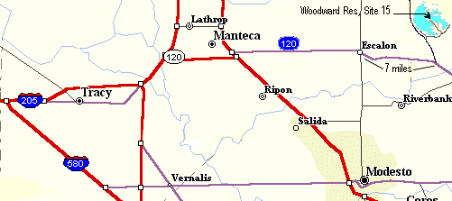
Visited on 2/19/2018 - Jeff and I took advantage of the unusually warm weather we had during the three day holiday weekend to take in the beauty of some lakes in the Mother Lode Gold Country of the Sierra Mountain foothills area. We loaded up the truck camper for a long weekend of camping and on our third day on our way home we traveled northwest from Lake McClure to Woodward Reservoir located 8 miles north of Oakdale, California. Woodward Reservoir is at an elevation of 210 feet in the low, rolling, grassy foothills of the Central Valley. The lake has a surface area of 2,900 acres with 23 miles of shoreline. On the day that we arrived and took this picture we spoke to the Park Ranger at the Entrance gate and we asked why the lake level was so low. She stated that they recently experienced a problem with their dam and they had to drain down the lake in order to perform required maintenance to repair the dam. Yikes, I hope we get the rain to fill this lovely lake back up to it's full capacity soon.


Visited on 2/19/2018 - Jeff and I took advantage of the unusually warm weather we had during the three day holiday weekend to take in the beauty of some lakes in the Mother Lode Gold Country of the Sierra Mountain foothills area. We loaded up the truck camper for a long weekend of camping and on our third day on our way home we traveled west from Lake McClure to Turlock Lake Recreation Area located 25 miles east of Modesto, California. Turlock Lake is at an elevation of 250 feet in the rolling hills of the Central Valley. The lake has a surface area of 3,500 acres with 26 miles of shoreline. Bounded on the north by the Tuolumne River and on the south by Turlock Lake, the recreation area provides an ideal setting for water-oriented outdoor activities. The recreation area features the lake with its 26 miles of shoreline and the foothill country leased from the Turlock Irrigation District in 1950. Picnicking, day-use, and boat launch ramps are offered at the lake. Overnight visitors are welcome at the 66 site campground located on the shady south bank of the Tuolumne River about 1 mile from the lake. From several lookout point, visitors can view the surrounding savannas and some of the cattle ranches and orchards nearby. And from Lake Road which separates the campground from the day use area, an excellent perspective is shown of the campground, the river and sloughs, and miles of dredger tailing piles-the by product of a half century of gold mining. Jeff and I had a great time getting the dogs out for a run on the beach with the chuck-it and ball.


Almond Orchards surround this area. This time of year the trees are already in bloom because of the warm weather we are experiencing in the month of February.
Jeff throwing the ball for the dogs down the trail to the Lake. So much fun....and of course they had to take a dip in the Lake once they got too warm from all the activity.
We crossed the coolest covered bridge located at Robert's Ferry. We were worried about clearing the roof of our truck camper on this bridge, but as we approached we realized we were fine when we saw the clearance sign was 15'3 feet and our camper is 12'6. Whew!!!!
Visited on 2/18/2018 - Jeff and I took advantage a unusually warm weather we were having during the three day holiday weekend to take in the beauty of some lakes in the Mother Lode Gold Country Sierra Mountain foothills area. We loaded up the truck camper for a long weekend of camping and on our second day we traveled on a very long narrow Rock Creek Road several miles to find Salt Springs Reservoir near Copperopolis, California. Along the way we were only able to go about 5 miles per hour so we didn't shake the dishes out of the cabinets in the camper! Once we reached the top of the hill we made it to the lake. Salt Valley Spring Reservoir is a remote 975 acre artificial lake that was formed by the construction of Salt Springs Valley Dam across Rock Creek in the Bear Mountains of Calaveras County. This lake is located at 1,074 feet above sea level.
Rock Ridge Road is very narrow and extremely bumpy with lots of patches from many years of repairs. Not recommended for truck campers with glassware in the cabinets!

Visited on 2/18 -2/19/2018 - Jeff and I took advantage a unusually warm weather we were having during the three day holiday weekend to take in the beauty of some lakes in the Mother Lode Gold Country Sierra Mountain foothills area. We loaded up the truck camper for a long weekend of camping and our fourth stop was this wonderful 7,100 acre 82 miles of pine and oak covered shoreline of Lake McClure. We camped overnight at one of the three large recreation areas on the Lake at Barrett Cove which is located 40 miles east of Modesto, California at an elevation of 867 feet above sea level. It is formed by the New Exchequer Dam impounding the Merced River, which is a tributary of the San Joaquin River. The lake was first created by the original Exchequer Dam, built between 1924 and 1926, a concrete gravity arch dam. In 1926 its name was changed to Lake McClure to honor Wilbur Fiske McClure, Head Engineers of the State of California, who helped develop and lay out the John Muir Trail in the Sierra Mountains of California. New Exchequer Dam was built in 1967 to increase the reservoir's capacity. It is a rock-fill dam with a reinforced concrete face, owned by the local Merced Irrigation District, which supplies northern Merced County farms with water for irrigation through its 750-mile network of canals. Besides storing water for irrigation, the lake also provides opportunities for recreation. Only a small amount of water from the lake is used for drinking water, and human contact is allowed. This is my second time to this lake, I also visited this lake on the far east side on 10/3/2017 while driving from giving an operator examination at Mount Bullion Conservation Camp in Mariposa, CA. In the summer of 2017 this area was ground zero for a major forest fire that burned several hundred areas of these hillsides.


Our pups love to chase and fetch the stick in this arm of the lake, just below the south boat ramp. The Lake was a little low, about 70-80 feet. Where I am standing it would have been under water last year.
Just a few diehard fisherman launching on this cool February day at Lake McClure. Lake was calm with a slight breeze.
We had Loop "J" to ourselves, no one else was camping in our area. We liked this camping spot at Barrlett Cove Campground, Loop J, space #3. Overlooks the lake and not far from the boat launching ramp for future trips with our boat. It was the only site that had a fire ring. I think it was one that a previous camper snuck in, so we made good use of it during our stay. Lots of downed blue oak branches for firewood to take the chill off.
 Pictures taken on the east side of the lake along Highway 49 between Bear Valley and Coulterville.


Visited on 2/3 -2/4/2018 - Jeff and I loaded up the truck camper for a weekend of camping on Black Butte Lake for the weekend and brought our two pups Summer and Skye. Black Butte Lake is at an elevation of 512 feet above sea level. Black Butte Lake was formed in 1963 upon the completion of Black Butte Dam. Located on Stony Creek 9 miles west of Orland, the lake is an inviting and accessible recreation area on the west side of the Sacramento Valley, with Mendicino National Forest as a backdrop to the west. When full, the lake has a surface area of 4,460 acres, is seven miles long and has a shoreline of 40 miles. The dam provides flood damage protection for local towns and agricultural lands. The monotony of driving Interstate 5 in California can be numbing. Whether going north or south, seemingly endless miles of flat land unfold in every direction. Though there are usually mountains on the horizon, they are distant and often difficult to access, do little to disrupt the drudgery of getting where one is going. However, there is an obscure remedy to this ailment. To the west of the farming of community of Orland, a surprising oasis of terrain looms closer to the highway than the faraway mountains. The Orland Buttes, a trio of large volcanic ridges, emerge unexpectedly from the grassy fields of the western Sacramento Valley, forming a 500 foot tall rocky escarpment. They are often difficult to perceive from the freeway due to their distance, though the tallest butte, Orland Mesa, is evident if one is paying attention. Unfortunately, the Buttes are almost entirely on private land. Thankfully, the northernmost of the three buttes, Black Butte, is on land owned by the Army Corps of Engineers, and thus provides a respite to those travelers on I-5 weary of the horizontal.
Black Butte is a long ridge composed of dark, chunky basalt, similar to the Lovejoy basalt. This rock formation is found along Big Chico Creek in Bidwell Park near Chico, or North Table Mountain, near Oroville. Similar rock also composes the Table Rocks along the Rogue River, in Oregon. On Black Butte, the rock forms a dramatic band of cliffs that wrap around the southern and eastern sides of the butte. On the west and north side, the rock protrudes from the grassy slopes. In contrast to the black rock are the gentle slopes beneath the cliffs and the blue waters of Black Butte Lake. Black Butte is the northernmost of the Orland Buttes. Although the basalt cliffs are striking, the mountain is not particularly high. Nonetheless, its lower elevation is offset by the flatness of the surrounding terrain, imbuing the small peak with more drama than its slight elevation would indicate.
Black Butte is under the jurisdiction of the Army Corps of Engineers because of its location adjacent to Black Butte Lake, a reservoir formed by the impoundment of Stony Creek, which flows off of Snow Mountain, then flows north 30 miles toward Black Butte. Beyond the Orland Buttes, the creek turns east and flows into the Sacramento River. It is easy to imagine the dramatic passage of the creek through the gap in the rock wall of the buttes in the place now occupied by the Black Butte Dam. In spring, the lake is one of the more attractive reservoirs in the state, boasting a grassy, treeless shoreline, fields of wildflowers and beautiful oak forests, all overseen by the dramatic cliffs of the Orland Buttes. Black Butte itself has inspiring views, taking in many of Northern California’s most notable landmarks, including Mount Shasta, Lassen Peak, the Yolla Bolly Mountains, Shasta Bally and Bully Choop Mountain, Snow Mountain, the Sierra Nevada, the Sutter Buttes, and the Sacramento Valley itself.


Black Butte Lake at sunset looking off to the southwest from our camping spot in the Buckhorn Campground, site #3.
The Army Corps of Engineers have done a great job of developing the trails on the northwest side of this Lake. Jeff and I hiked the Bobcat Trail from the Buckhorn Campground to the Ranger Entrance Station with our two dogs. It was a great 2 mile hike and we saw a herd of ten deer along the trail.
After our afternoon hike it was time for a nap in the camper! Jeff and Summer hard at it!
Jeff and I took a nice drive through some of the ranch area and orchards just north of Black Butte Lake and came upon a herd of about 80 buffalo at Black Bison Ranch. This guy was just walking along minding his own business, not paying attention to us at all.
Visited 02/03/2018 – Jeff and I loaded up our two dogs, Summer and Skye and took a nice weekend camping trip up to Black Butte Lake / Reservoir. We visited three lakes/reservoirs on our trip that are located on the western edge of the Sacramento Valley along the foothills of the Mendocino National Forest. First stop was East Park Reservoir which is the only lake on my list of 300 that is located in Colusa County, California. Located 30 miles west of the town of Maxwell, this reservoir was hard to get to because they close all the access roads for the camping areas on the east side of the lake during the winter months. We traveled to the west side through the town of Stonyford and attempted to enter the lake from the north side. All we encountered after a very bumpy 2 mile one lane road was another gate. This reservoir is 1,820 acres and rests at an elevation of 1,205 feet above sea level.