Thursday, June 28, 2018

Lake Ramona - San Diego County, California


Visited on 6/25/2018 after administering a Wastewater Treatment Plant operator examination near Fallbrook, California.  Lake Ramona is a small 155 acre lake just west of Ramona, California.  Lake Ramona is located in the hills above the town of Ramona at 1,305 feet above sea level.   
Lake Ramona was built in the 1980’s as a storage facility to provide inexpensive water for local agricultural needs as well as an emergency storage in case a shortage should arise. Access to this lake is rather difficult and great for endurance, therefore keeping the population of people low. I recommend this trip in fall, winter and spring as it gets HOT out here in summer.

It is almost 3 miles one way and much of it is climbing up hill. You must go through the Blue Sky Reserve in Poway to get to this lake, which is quite beautiful and forested with greenery and flowers in the spring.

The lake is open year-round from sunrise to sunset. They close the gates in the parking lot at sunset so plan your trip accordingly! Make sure to bring snacks too as this hike works up an appetite!  There is no swimming allowed but you can fish. 


Wednesday, June 27, 2018

El Capitan Reservoir - San Diego County, California


Visited on 6/25/2018 after giving an examination to a Wastewater Treatment Plant operator near Fallbrook, California.  The El Capitan Reservoir was created in 1935 with the completion of the El Capitan Dam. That same year the reservoir was connected to the City's water system via the El Capitan Pipeline. Located approximately 30 miles northeast of downtown San Diego, on the San Diego River, El Capitan had the largest capacity in the City reservoir system until the San Vicente Dam Raise Project was completed in 2015. When full, the reservoir has 1,562 surface acres, a maximum water depth of 197 feet, and 22 miles of shoreline.  El Capitan Reservoir is 750 feet above sea level.  Water levels are monitored weekly.

Dogs must be kept on a leash at all times and at least 50 feet away from the water. Dogs are not allowed on any boats. There is no camping allowed at El Capitan.
 

Lake Jennings - San Diego County, California

 
Visited on 6/25/2018 after given an examination near Fallbrook, California.  Lake Jennings is a small 85 acre lake just east of Lakeside, California.  Lake Jennings at 700 feet above sea level is known for being one of the most scenic parks in all of San Diego County. The 4 miles of fairly steep shoreline is semi-arid dotted with sumac trees and few pine trees. 

It is a welcoming recreation destination located in Lakeside, California offering fishing, camping, hiking, and picnicking activities. The lake is a drinking water reservoir owned and operated by Helix Water District. The scenic views of the lake and the wooded surroundings make it feel as if you are in the middle of the wilderness, right outside of town.


Lake Sutherland - San Diego County, California


Visited on 6/25/2018 after administering an examination to a Wastewater Treatment Plant operator near Fallbrook, California.  I ventured 45 miles northeast of San Diego to Sutherland Reservoir.  When full, the reservoir has 557 surface acres and is located at 2,074 feet above sea level with a maximum water depth of 145 feet, and 5.25 shoreline miles. The area has oak and chaparral around the shoreline.  Water levels are monitored weekly.  Construction on Sutherland Dam began in 1927, but it was not completed until 1954.  

Lake Sutherland is owned by the City of San Diego, and the Ramona Municipal Water District also has access to the water, therefore dogs must be kept on a leash at all times and at least 50 feet away from the water. Dogs are not allowed on any boats. There is no camping allowed at Sutherland.
 
A civil engineer named Post surveyed the site near John Sutherland’s property in the early 1920s. As a show of gratitude for Sutherland’s kindness during Post’s survey, Post titled his submission: “Survey of Sutherland Dam Site.” Mr. Sutherland was well-known in the area as a Ramona pioneer, real estate developer and rancher.

Construction began on the dam over Santa Ysabel Creek in 1927, but was halted in 1928 for decades after a battle over water rights erupted between Escondido and San Diego. Construction resumed in 1952 after funding was secured and all water disputes were resolved. With one-quarter of the dam already complete and most of the wooden supports still in place, the dam was finished by the Daley Corporation of San Diego and Bent Construction Company of Alhambra in little more than a year and dedicated on
June 5, 1954 to a crowd of more than 300 citizens and dignitaries.

The dam is impressive, especially when there is very little water behind it, because one can clearly observe the engineering required in its construction. Seventeen curved semi-ecological arches between eighteen buttresses soar 161 feet over the creek bed to a width of 1,240 feet; concrete ten feet thick at the base tapers to only forty inches at the top… just wide enough for a walkway across the top of the dam. The spillway keeps water levels below 145 feet, a level that has not been reached since the 1990s. Sutherland Dam is said to be one of the most earthquake-proof dams in Southern California. That’s reassuring, considering that a 100-year-old historic bridge crosses Santa Ysabel Creek less than two miles from the dam in the direct inundation zone.

Portions of the lake’s eastern shoreline were added to the San Dieguito River Park in 2005 and trails are planned that will contain a segment of the still-being-constructed Coast-to-Crest Trail across San Diego County’s backcountry to the ocean. The trail will cross what remains of a 1896 homestead, which was a stop on the Julian-to-Ramona stagecoach route, and the San Dieguito River Valley Conservancy is still removing remnants of the farming operations. Herds of cattle and donkeys still periodically graze at the shoreline. Extensive damage was done to the landscape in the 2007 Witch Creek Fire, but Nature is staging an impressive comeback.
Standing behind the dam is Corral Mountain, which can be accessed by various fire roads and lies behind ominous “No Trespassing” signs.


San Vincente Reservoir, San Diego County, California


Visited on 6/25/2018 after giving an examination to a Wastewater Treatment Plant Operator for work.  San Vicente Reservoir is a deep, steep-sided impounding reservoir on San Vicente Creek, approximately 25 miles northeast of San Diego. It currently has a depth of 659 feet above sea level when full. Water levels are monitored weekly.

No swimming or wading permitted; body contact only permitted as incidental to water contact activities (water-skiing, wakeboarding, etc.).
The City of San Diego, in partnership with the San Diego County Water Authority, designed and built the dam raise project to ensure a six-month supply of drinking water for the San Diego region in the event imported water deliveries are interrupted or impacted by drought. The dam raise added 152,000 acre-feet of water storage capacity to the reservoir.  San Vicente Reservoir is by far the largest reservoir in San Diego County in terms of water volume and total capacity, more than twice that of the 2nd largest reservoir, El Capitan.

The original dam at San Vicente Reservoir was completed in 1943, creating a reservoir with 1,069 surface acres and 14 miles of shoreline with a maximum depth of 190 feet. In 2009, the San Diego County Water Authority began a project to raise the dam an additional 117 feet, allowing the lake to store an additional 152,000 acre feet of water providing another 500 surface acres. That project was completed in 2012, and the reservoir reopened on September 22nd, 2016 after a new marina and dock facilities were added.
San Vicente Reservoir is now a 1,680 acre lake owned and operated by the city of San Diego.


Lake Henshaw - San Diego County, California


Visited on 6/25/2018 after giving an examination to a Wastewater Operator in Fallbrook, California.  I ventured east and found this peaceful lake in a very dry valley.  Lake Henshaw is a Reservoir in San Diego County, California at the southeast base of Palomar Mountain, approximately 70 miles northeast of San Diego, California and 100 miles southeast of Los Angeles.

The lake covers approximately 1,140 acres and sits at an elevation of 2,723 feet above sea level.  The lake was intentionally lowered in 1978 from its original capacity of out of earthquake concerns. It drains an area of 207 square miles square miles at the source of the San Luis Rey River.
The lake was constructed in 1923 with the building of Henshaw Dam, an earth dam 123 feet tall and 650 feet long. It is owned by the Vista Irrigation District and used primarily for agricultural irrigation.

The lake features excellent opportunities for fishing for both catfish and carp. Boats are available for rental through the general store nearby.


Vail Lake - Riverside County, California


Visited on 6/25/2018 after given an examination near Fallbrook, California.  Vail Lake is located on Temecula Creek, in the Butterfield Valley, south of Oak Mountain, of the Black Hills, in the Santa Margarita River watershed. It is approximately 15 miles east of Temecula, California and is in the Cleveland National Forest among giant oak trees that dot the 15 miles of mountainous shoreline.

Vail Lake covers approximately 1,100 acres at an elevation of 1,426 feet above sea level and is supplied by storm water runoff from Kolb, Temecula, and Wilson Creeks. Surface water stored in the lake is used to help replenish local ground water supplies through recharge operations.  Vail Lake was created in 1948 when the owners of the Vail Ranch constructed the 132-foot high Vail Lake Dam, which has been owned and operated by the Rancho California Water District since 1978.

The property surrounding Vail Lake is privately owned, and recreational access to the lake is privately controlled. The Butterfield Country Recreation Park was established in 1968 to provide public access to the lake and its marina, but the park was closed by its owners in 1989.  In 1995, a members-only resort facility was opened at the location of the former park; and in 2000, the area was re-opened to the public on an annual-fee basis. Recreational activities at Vail Lake include fishing, boating, RV, mountain biking, miniature golf and swimming.

Land near Vail Lake is the only known native habitat of the endemic and endangered flowering shrub Ceanothus ophiochilus, which was named the Vail Lake ceanothus when it was discovered in 1989.
 

Sly Creek Reservoir - Butte County, California


Visited on 6/23/2018 while taking a trip to the Sierra with our dogs and our boat to enjoy a couple of higher elevation lakes to escape the 104 degree Sacramento Valley temperatures.  Sly Creek Reservoir is a one-in-a-million location in Northern California for a beautiful day on the lake boating and would be a guaranteed spot to provide pristine paddling venue with my new kayak.  This 563 acre reservoir is located at 3500’ feet elevation in the southern region of the Feather River Ranger District of the Plumas National Forest. There are many secluded beaches and good fishing spots to be found.
The reservoir is a premier paddling paradise for kayakers, and the drive to get there on the newly paved access road was almost as exquisite as the reservoir itself.   This is really a magnificent reservoir, even though it is a pain in the rearend to get there. It is hard to find because the sign down on the highway was hidden by overgrown trees and I am sure many people get lost.

The lake's water level was very high on the day we visited and the water was very clear.  Our dogs really enjoyed fetching the stick in this lake during our visit.  We parked temporarily at the boat launch area which was very accessible, however we arrived too late to snag one of the limited boat trailer spots.  We ventured on up the hill to Little Grass Valley Reservoir to check out another area lake for the day.  The scenic terrain and tranquil atmosphere provides an ideal kayak haven for paddlers and boaters for a great retreat.  I can't wait to come back with the kayak for a fun day paddling around this beautiful and peaceful hidden gem.


Little Grass Valley Reservoir - Plumas County, California


Visited on 6/23/2018 while taking a trip to the Sierra Foothills with our dogs and our boat to enjoy a couple of higher elevation lakes to escape the 104 degree Sacramento Valley temperatures.  Little Grass Valley Reservoir is an 1,433 acre artificial lake in Plumas County, California and Plumas National Forest near the Pacific Crest Trail.
The lake's waters are impounded by Little Grass Valley Dam, which was completed in 1961.  The lake discharges into the South Fork Feather River.  The reservoir is at an elevation of 5,052 feet above sea level. 

Little Grass Valley Dam is a rock-fill dam 840 feet long and 210 feet high, with 18 feet of freeboard. The South Feather Water and Power Agency owns the dam.
Located in Plumas National Forest near the Pacific Crest Trail, Little Grass Valley Reservoir is the centerpiece of the Little Grass Valley Recreation Area, managed by the Feather River Ranger District. The area supports boating, camping, fishing, swimming, picnicking, horseback riding, mountain biking, wildlife viewing, and hiking.  By car, the lake is about ninety minutes from Yuba City, California.  The Pacific Crest Trail passes north of the lake and can be reached by way of the Bald Mountain Trail from Horse Camp.


Tuesday, June 19, 2018

Tule Lake - Siskiyou County, California


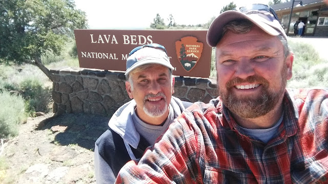
Visited on 6/17/18 returning from a weekend adventurous camping trip where we met up with Jeff’s brother, Brian and his two nieces Hannah and Lauren up at Lava Beds National Monument near Tule Lake, CA.  On our way home we drove down into the Tule Valley / Basin and navigated along the west side and across the north to the town of Tule Lake, CA.  The Lake is 13,000 acres large and is at 4,035 feet above sea level.  Tule Lake is an intermittent lake fed by the Lost River covering an area of 13,000 acres, 5 miles long and 3 miles across, in northeastern Siskiyou County and northwestern Modoc County in California, along the border with Oregon.
Canby's Cross is located about three miles south of the lake; it is the site where General Edward Canby was killed by the Modoc chief Kintpuash, also known to American settlers as Captain Jack.

During World War II, the United States federal government forced the evacuation of Japanese nationals and Japanese Americans, including citizens born in the United States, to numerous camps built in the interior of California and inland states. They were forced to sell their businesses and homes, and suffered enormous economic and psychological losses by being treated as potential enemies. The Tule Lake War Relocation Center, a Japanese American internment camp, is located to the east in neighboring Modoc County. Following World War II, the federal government awarded 86 farm sites on land reclaimed by the drainage of Tule Lake to returning veterans using a Land Lottery.  A lottery was used because the number of applicants was greater than the number of homesteads available Tule Lake Refuge is located in the fertile and intensely farmed Tule Lake Basin of northeastern California. It was established in 1928 by President Calvin Coolidge as a,“preserve and breeding ground for wild birds and animals.”  This 39,116-acre refuge is mostly open water and crop land.  Approximately 17,000 acres are leased by potato, onion, horse radish, alfalfa, and cereal grains within the Public Lease Lands program administered by the U.S Bureau of Reclamation. Permit holders farm an additional 1,900 acres in cooperation with the U.S. Fish and Wildlife Service (FWS).The endangered Lost River and shortnose suckers live in or use this refuge.
The refuge is a significant staging area for migrating waterfowl during spring and fall migrations. It is used primarily by whitefronted, snow, Ross, and cackling Canada geese, all of which nest in the Arctic tundra. Tule Lake hunting opportunities consist of two large marsh units accessible by boats, a spaced-blind hunt in dry fields, and open free-roam areas offering field hunts over harvested grain and smaller marsh units. A 10-mile auto tour route allows for wildlife observation throughout the year.


View from the West side of the lake.

Jeff with in his cave exploring gear!


Medicine Lake - Siskiyou County, California


Visited on 6/17/18 returning from a weekend adventurous camping trip where we met up with Jeff’s brother, Brian and his two nieces Hannah and Lauren up at Lava Beds National Monument near Tule Lake, CA.  On our way home we stopped drove into the Modoc National Forest to an elevation of 6,770 above sea level to check out the campgrounds and facilities offered at Medicine Lake.  It is a 640 acre lake that is located 10 miles southwest of Lava Beds National Monument and 30 miles northeast of Mount Shasta, CA.
Medicine Lake is considered one of the most gorgeous lakes in California. It is located far off the beaten path, but the long drive is worth every bump when you catch that first breath-taking glance of the lake sparkling against a backdrop of thick woods. It's deep blue in color and doesn't have any water coming in or out of the lake except for rainfall and snowmelt. Once the center of a volcano, this 640 acre lake is said to be at least 150 feet deep in places.

The lake lies within walking distance of the campsites. There is camping in four national forest campgrounds located along the northeast side of the lake.  Our favorite camping spot was #45 right on the lake shore.
Medicine Lake is in the caldera of the volcano, which measures 4.3 by 7.5 miles. The caldera may have formed by collapse after a large volume of andesite was erupted from vents along the caldera rim. The distribution of late Pleistocene vents, mostly concentrated along the rim, suggests that ring faults already existed when most of the andesite erupted. No single large eruption has been related to caldera formation. The only eruption recognized to have produced ash flow tuff occurred in late Pleistocene time, and this eruption was too small to account for formation of the caldera. Later conclusions were that Medicine Lake caldera formed by collapse in response to repeated extrusions of mostly mafic lava beginning early in the history of the volcano (perhaps in a manner similar to the formation of Kilauea caldera in Hawaii). Several small differentiated magma bodies may have been fed by and interspersed among a plexus of dikes and sills. Late Holocene andesitic to rhyolitic lavas were derived by fractionation, assimilation, and mixing from high alumina basalt parental magma. The small lake from which Medicine Lake volcano derives its name lies within the central caldera.


One of the greatest camping spots on the Lake at #45.

Fall River Lake - Shasta County, California


Visited on 6/15/18 on a weekend camping adventurous trip to meet up with Jeff’s brother, Brian and his two nieces Hannah and Lauren up at Lava Beds National Monument near Tule Lake, CA we stopped at Fall River Lake in the small town of Fall River Mills, CA.  Fall River Lake is a 194 acre lake located 14 miles east of Burney, CA and 69 miles east of Redding, CA.  At an elevation of 3,304 above sea level, this scenic area has a wealth of native wildlife and vegetation. The water is as clear and healthy as any waters in California. It is home to an eclectic mix of migrating ducks, deer, various eagle species, heron, osprey, and many animals. It is difficult to describe how intoxicating this place is and how mesmerizing it’s many vistas. The one aspect that has kept it almost entirely secret is the limited access.

Fall River Lake provides visitors with endless recreational opportunities.  Kayaking and canoeing are a popular activity. Anglers will find rainbow and brows to be plentiful. For birdwatchers and nature lovers, there is waterfowl of all kinds.  Fall River Lake attracts outdoor enthusiast who love wildness and waters of utmost purity!
The harmonious atmosphere at this visited lake can provide a tranquil paddle uninterrupted by noisy powerboat traffic and crowds.  Nature lovers, bird watchers, duck hunters and wilderness oriented fly fishers covet this treasure. Those who seek the out of the way paddling getaways will not be disappointed.

The rutted dirt access is not well-maintained nor is it well marked, which makes the lake a little difficult to reach. It may also be one reason there was only one other boat on the lake besides myself on a holiday weekend. There are a handful of primitive boat-in campsites along the shore with vault toilets (but no water).


Clear Lake Reservoir - Modoc County, California


Visited on 6/17/18 returning from a weekend adventurous camping trip where we met up with Jeff’s brother, Brian and his two nieces Hannah and Lauren up at Lava Beds National Monument near Tule Lake, CA.  On our way home we drove down into the Tule Valley and navigated our way on dirt rutted roads with storm clouds looming overhead, through cow pastures for miles until we found Clear Lake Reservoir.  This reservoir is located on the eastern side of the Tule Valley about 19 miles from Tule Lake, CA on U.S. Forest Land in the Modoc National Forest at an elevation of 4,498 above sea level.  It is a very large 24,800 acre reservoir that is very shallow.
 
The Clear Lake National Wildlife Refuge was established in 1911, this 46,460 acre refuge consists of approximately 20,000 acres of open water surrounded by upland habitat of bunchgrass, low sagebrush, and juniper. Small, rocky islands in the lake provide nesting sites for the American white pelican, doublecrested cormorant, and other colonial nesting birds. The upland areas serve as habitat for pronghorn antelope, mule deer, and sage grouse. Except for limited waterfowl and pronghorn antelope hunting during the regular California State seasons, the refuge is closed to public access to protect fragile habitats and to reduce disturbance to wildlife. The Clear Lake Reservoir is the primary source of water for the agricultural program of the eastern half of the Klamath Basin with water levels regulated by the U.S. Bureau of Reclamation.

For the wildlife enthusiast, a visit to the Klamath Basin Refuges at any season is a voyage of never–ending discovery. Year to year and season to season the dynamic ebb and flow of wildlife is a process of constant change. Over 490 wildlife species have been observed in the basin including 353 species of birds. Fall and spring bring the drama of one to three million ducks, geese and swans using refuge wetlands as a vital stopover in their annual migrations. Winter bald eagle numbers peak in mid February with basin populations ranking as the largest recorded in the contiguous United States. Thousands of wetland nesting birds also raise their young on the six Klamath Basin National Wildlife Refuges.

Located in Modoc County, California near the Oregon border, Clear Lake Reservoir stands statuesque among the surrounding hills and plains. The original earthfill dam was built across the Lost River in 1910 and replaced with a new concrete dam in 2002. Though the reservoir was first created to reduce water flow into the Tule Lake wetlands and store irrigation water for agricultural land, the area has since become home to one of the most important wildlife refuges in the state. Because of its large surface area (25,760 acres maximum) and relatively shallow depths, the reservoir has a high rate of evaporation during warm weather. Clear Lake Reservoir should not be confused with Clear Lake, a natural lake located in Lake County, California.

Modoc National Forest commands 1,654,392 acres of northeastern California real estate, housing within its boundaries the Warner Mountains, from the Cascade Range, and a forest bed that was covered by lava millions of years ago. In the lower elevations, visitors to the forest will find bitterbrush and curl-leaf mahogany, which slowly give way to a sprinkling of aspen, incense cedar, ponderosa pine, red fir, and white fir in higher elevations. At the forest's highest elevations, you'll find lodgepole and western white pines, as well as some startlingly beautiful vistas from your vantage point on top of the forest's summit.

Wind your way along nature trails that were once traveled by covered wagons and their brave passengers, their wheel ruts still carved into the canyon rock. Take a hike along a section of the famous Oregon Trail, experiencing the forest in almost the same state as those settlers many years ago. Walk the paths of the Native Americans and settlers who trapped, hunted, and fished for their living. Catch a glimpse of early 20th century life in Tom Smith's Cabin, now listed on the National Register of historic places. As you hike through the Modoc National Forest, you'll not only have a front row seat to the area's diverse wildlife, but you'll take a trip back in time.


Dorris Reservoir - Modoc County, California


Visited on 6/11/2018 on our way back from Springfield, Oregon to visit family and to attend Jeff’s niece, Hannah’s High School graduation ceremony.  We stopped on the way back to check out Dorris Reservoir just 3 miles east of Alturas, California.  This 1,060 acre reservoir is located in the Modoc National Wildlife Refuge at a location of 4,396 feet above sea level.  The mountains in the distance were beautiful with a light snow cap on the top of them.  Very peaceful and quiet area with just barn swallows swooping down near the dam when we visited.

Located at #2 on this map is Dorris Reservoir.

I tried to capture the barn swallows swooping along the shoreline of Dorris Reservoir.

Big Sage Reservoir - Modoc County, California


Visited on 6/10/2018 on our way back from Springfield, Oregon to visit family and to attend Jeff’s niece, Hannah’s High School graduation ceremony.  We stopped on the way back to check out this nice remote lake with wild horses and cattle grazing around the beautiful peaceful lake.  Big Sage Reservoir rests at an elevation of 4,400 feet on a sage and juniper covered plateau.  This 5,400 acre is located 8 miles north of the City of Alturas.  The water edge was difficult to navigate in our truck camper on the unpaved trail that led down to the lake.  We hiked down to the lake by navigating near grazing cattle and some wild horses.  The dogs played in the water to cool off as we kept one eye on the nearby cattle with calves to make sure they didn’t charge us!  On our way up to the lake we passed Devil’s Garden Conservation Camp built and maintained by the California Department of Fire and the California Department of Corrections and Rehabilitation.  They help fight forest fires and maintain the roads in the area.


West Valley Reservoir - Lassen County, California


Visited on 6/9/2018 on our way back from Springfield, Oregon to visit family and to attend Jeff’s niece, Hannah’s High School graduation ceremony.  We stopped on the way back home to check out this nice reservoir.  West Valley Reservoir is in the northeastern corner of California at an elevation of 4,770 feet, east of Highway 395 near the town of Likely, California.  This 970-acre Reservoir Located in high desert terrain with lava rock, Sage brush, and Juniper.   It has a shoreline of 7 miles which is usually frozen over from December to early March.  West Valley is owned and administered by Modoc County.  We traversed unpaved roads with our truck camper to get a good vantage point to view this lake.  It is somewhat remote and has limited facilities for the primitive camper.


Clear Lake - Modoc County, California


Visited on 6/11/2018 on our way back from Springfield, Oregon to visit family and to attend Jeff’s niece, Hannah’s High School graduation ceremony.  We decided to venture back to hike to Mill Creek Falls and hike to a small lake at the top of the ridge just beyond the falls.  We drove back to the Mill Creek Falls Campground which is located at the south end of the beautiful and lush Warner Mountain Range. This range is wetter than most in this area, largely due to its relatively higher elevation and volcanic origin (volcanic rock does not absorb water and it is more fertile).

The Falls are very nice and they were full of water when we visited.  Clear Lake is a beautiful small lake about a ¼ mile hike on over the ridge from the Mill Creek Falls and trail head directional signage.  We first hiked uphill ¼ mile to the overlook for the beautiful Mill Creek Falls.  Camping Sites 10 - 14 are close enough to the waterfalls that they can be heard...a dull roar, but a pleasant white noise. Great for sleeping.

The Clear Lake/Poison Flat Trails depart from the back of the campground. From the trailhead, it is approximately 10 minutes to Mill Creek Falls (no more than 100' elevation change whole route). Mill Creek Falls is one of the largest waterfalls in Modoc County.


.